Mumbai - Bombay topographic map
You can find on this page the Mumbai - Bombay topographic map to print and to download in PDF. The Mumbai - Bombay elevation map present the topography, river and relief of Mumbai - Bombay in Maharashtra - India.
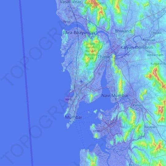
Mumbai - Bombay elevation map
The Mumbai - Bombay topographic map shows elevation, hills and landforms in Mumbai - Bombay. This elevation map of Mumbai - Bombay will allow you to know topography, river and relief of Mumbai - Bombay in Maharashtra - India. The Mumbai - Bombay topographic map is downloadable in PDF, printable and free.
Mumbai is bounded by the Arabian Sea to the west. Many parts of the city lie just above sea level, with elevations ranging from 10 m (33 ft) to 15 m (49 ft); the city has an average elevation of 14 m (46 ft) as you can see in Mumbai - Bombay elevation map. Northern Mumbai (Salsette) is hilly, and the highest point in the city is 450 m (1,476 ft) at Salsette in the Powai-Kanheri ranges.