Mumbai - Bombay neighborhood map
You can find on this page the Mumbai - Bombay neighborhood map to print and to download in PDF. The Mumbai - Bombay districts map presents quarters, region, suburbs and surrounding area of Mumbai - Bombay in Maharashtra - India.
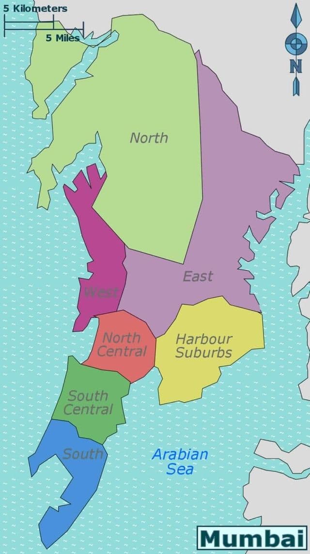
Mumbai - Bombay neighborhoods map
The Mumbai - Bombay neighborhoods map shows region and suburbs of Mumbai - Bombay areas. This neighborhood map of Mumbai - Bombay will allow you to discover quarters and surrounding area of Mumbai - Bombay in Maharashtra - India. The Mumbai - Bombay quarters map is downloadable in PDF, printable and free.
The Fort neighborhood in South Mumbai gets its name from Fort George, which the British East India Company built there in 1769. Although the fort was demolished in 1865, a small portion still remains. It has some of the finest Victorian Gothic buildings in the world including Chhatrapati Shivaji Terminus Railway Station, plus the Town Hall, and institutions such as the Reserve Bank of India and Bombay Stock Exchange as its mentioned in Mumbai - Bombay neighborhoods map . Bordering Fort, Colaba was one of the seven islands, separated by swamps, that originally made up Bombay. Its main thoroughfare, Colaba Causeway, was constructed by the British East India Company in 1838. Rapid development of the neighborhood followed, and it has now morphed into the city unofficial tourist district. The neighborhood continues to have an old-world feel, with predominant Colonial and Art Deco styles of architecture.
Mumbai - Bombay districts map
The Mumbai - Bombay districts map shows all quarters and suburbs of Mumbai - Bombay. This district map of Mumbai - Bombay will allow you to discover areas and the region of Mumbai - Bombay in Maharashtra - India. The Mumbai - Bombay districts map is downloadable in PDF, printable and free.
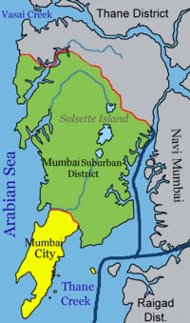
Mumbai consists of two distinct regions as its mentioned in Mumbai - Bombay districts map: Mumbai City district and Mumbai Suburban district, which form two separate revenue districts of Maharashtra. The city district region is also commonly referred to as the Island City or South Mumbai. Mumbai lies at the mouth of the Ulhas River on the western coast of India, in the coastal region known as the Konkan. It sits on Salsette Island, partially shared with the Thane district.