Mumbai - Bombay city map
You can find on this page the Mumbai - Bombay map to print and to download in PDF. The Mumbai - Bombay offline map presents the city center and the location in world map of Mumbai - Bombay in Maharashtra - India.
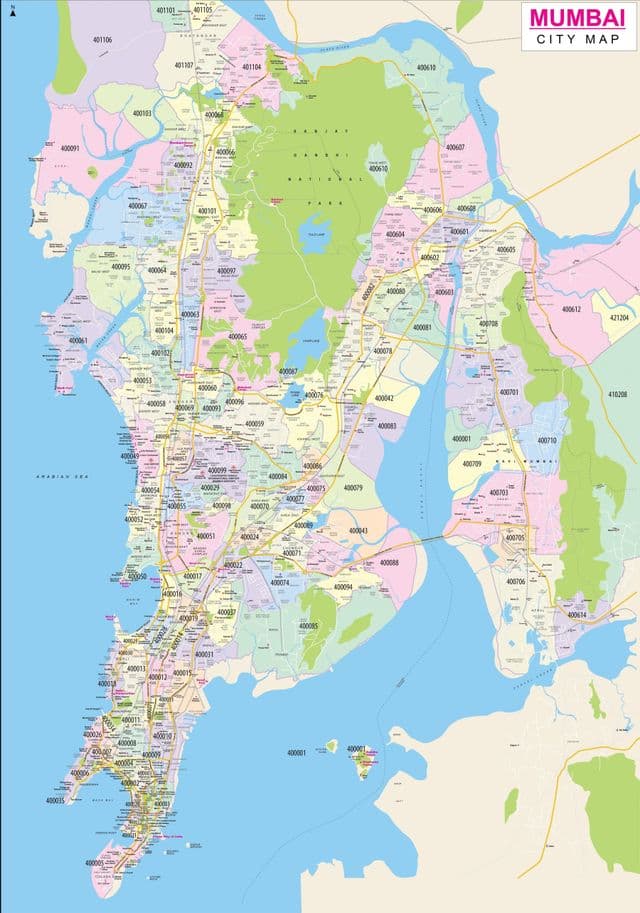
Mumbai - Bombay map
The Mumbai - Bombay map shows the detailed map and a large map of Mumbai - Bombay. This map of Mumbai - Bombay will allow you to orient yourself in Mumbai - Bombay in Maharashtra - India. The Mumbai - Bombay map is downloadable in PDF, printable and free.
The total area of Mumbai is 603.4 km2 (233 sq mi) as you can see in Mumbai - Bombay map. Of this, the island city spans 67.79 km2 (26 sq mi), while the suburban district spans 370 km2 (143 sq mi), together accounting for 437.71 km2 (169 sq mi) under the administration of Brihanmumbai Municipal Corporation (BMC). The remaining area belongs to Defence, Mumbai Port Trust, Atomic Energy Commission and Borivali National Park, which are out of the jurisdiction of the BMC. Mumbai lies at the mouth of the Ulhas River on the western coast of India, in the coastal region known as the Konkan. It sits on Salsette Island, partially shared with the Thane district.
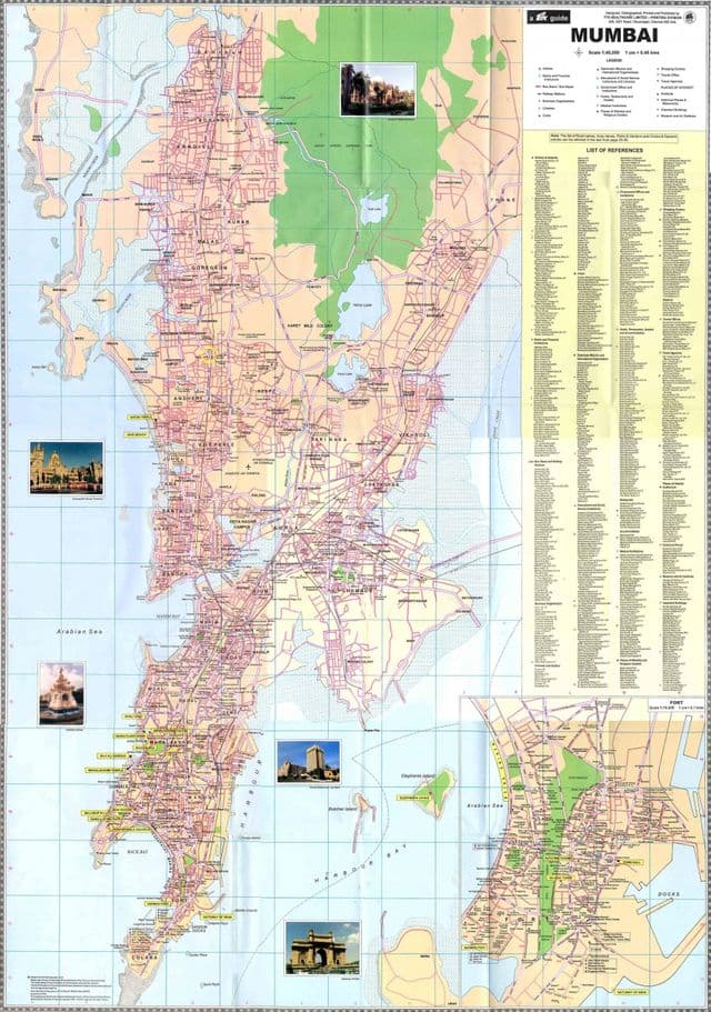
Mumbai - Bombay downtown map
The map of downtown Mumbai - Bombay shows the historical center of Mumbai - Bombay. This downtown map of Mumbai - Bombay will allow you to easily plan your visit in the center of Mumbai - Bombay in Maharashtra - India. The Mumbai - Bombay downtown map is downloadable in PDF, printable and free.
Central or downtown and West Mumbai are the city center and consists of popular areas like Bandra, Andheri and Juhu as you can see in Mumbai - Bombay downtown map. The International Airport is situated here and so is the National Stock Exchange building and other financial sectors on Dalal Street. The areas proximity to the international and domestic airport makes it an easily accessible zone and most of the good hotels and properties are situated here within a 2-3 kms area. Nearby attractions include Siddhivinayak Temple in Andheri, the Marine Drive, Mahim Church and the Bandra area is famous for its Bandstand Promenade and Carter Road.
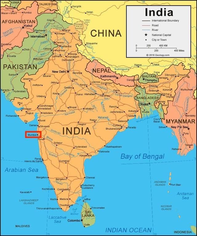
Mumbai - Bombay Maharashtra - India map
Mumbai - Bombay on Maharashtra - India map shows the location of the city of Mumbai - Bombay on the Maharashtra - India map. This map of Mumbai - Bombay in Maharashtra - India will allow you to easily plan your travel in Mumbai - Bombay in Maharashtra - India. Mumbai - Bombay on map of Maharashtra - India is downloadable in PDF, printable and free.
Mumbai - Bombay Maharashtra /mʊmˈbaɪ/, also known as Bombay /bɒmˈbeɪ/, is the capital of the Indian state of Maharashtra as its shown in Mumbai - Bombay Maharashtra - India map. It is the most populous city in India and lies on the west coast of India and has a deep natural harbour. Mumbai is also the richest city in India, and has the highest GDP of any city in South, West or Central Asia.
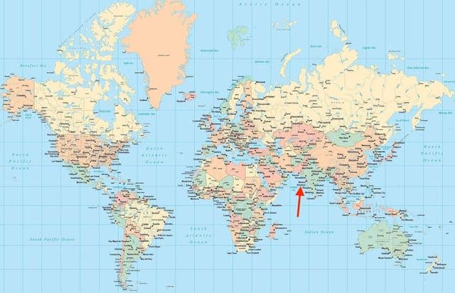
Mumbai - Bombay on world map
Mumbai - Bombay on world map shows the location of the city of Mumbai - Bombay in the world. Mumbai - Bombay on world map will allow you to easily know where is Mumbai - Bombay in the world. The Mumbai - Bombay in world map is downloadable in PDF, printable and free.
Mumbai - Bombay is the fourth most populous city in the world, with a total metropolitan area population of approximately 20.5 million as you can see in Mumbai - Bombay on world map. Along with the neighbouring urban areas, including the cities of Navi Mumbai and Thane, it is one of the most populous urban regions in the world. In 2009, Mumbai - Bombay was named an Alpha world city.